 BACK
BACK
The map on this page depicts Boston neck as it appeared in 1729.
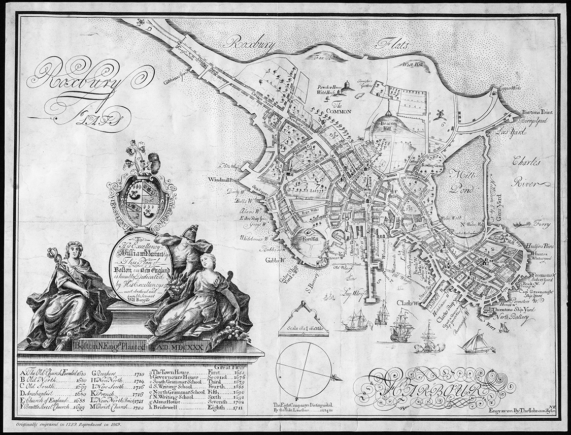
He took the detail from the 1722 Map done and added some updates in the seven years that has past.
Start with the triangle that shows the scale just above the compass (bottom center of the map).
Move your eyes strait up from the triangle and you will see Fort Hill. Two streets up from that is Long Lane. It runs between Cow Lane and Milk Street.
At the end of 1729, the townspeople of Boston gave permission for the "Irish Immigrants" (our Scots-Irish Calvinists) to use an old barn that existed at
corner of Long Lane and Milk Street. The congregation grew so quickly, due the the continued immigration of Presbyterians that two wings were added
to the building. The congregation continued to grow and by 1744 they built a new church. The present Arlington Street Church stands on the same locaiton.
If you continue your sight slightly up and to the left, you will see a point of land jutting out marked Windmill Point and just up from that is Hill's Warf. That Hill's warf
is the location identified in city records as the place where John Harper wanted to retail "strong drink". One can speculate that his petition was denied due to his
"Irish" identity.
This
site maintained by Rick
Harper
Images copyright 1998, 1999, 2000, 2001, 2002, 2003, 2004, 2005,
2006, 2007, 2008, 2009
All rights reserved