 |
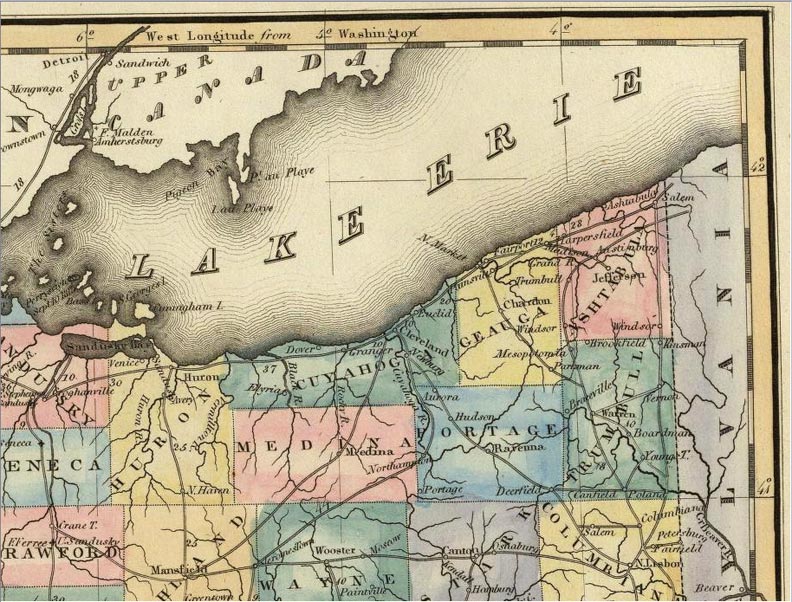
1823 Map of NE Ohio Counties (Note 'Roads' connecting the principal villages) |
 |
|
This map is from the World Atlas by Lucas Fielding. (Note! Longitude is shown as degrees West of Washington City. Map Dated 1823 Look for the location of roads, such as they were, linking major towns and villages. Note also, in Trumbull Township, below Ashtabula, Youngs T. and Boardman are reversed from their actual location. Note also that this was done before Lake County was was partitioned from Geauga County. Summit County would later be created from parts of Medina and Portage Counties. Think about the time it took Robert to travel first to Chillicothe then Columbus on horseback to fulfill his elected duties.
|
|
 |
This site
maintained by Rick Harper Images copyright 1998, 1999, 2000, 2001, 2002, 2003, 2004, 2005, 2006 All rights reserved |