 |
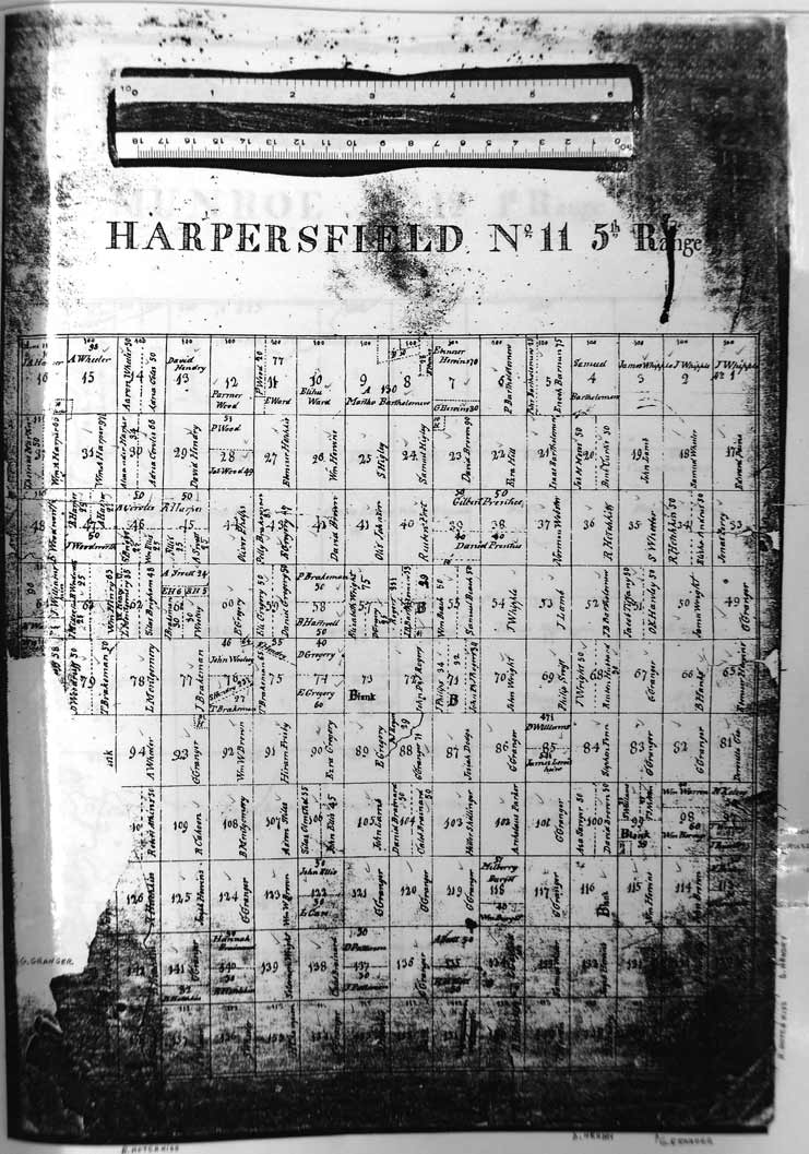
1820
Map of Harpersfield Township |
 |
|
Within Harpersfield Township the lots identified in Alexander
Harper's Probated Will are shown. The individual lots are as follows: Lot Acres The above lots were under the incumbrance of a mortgage to the State of Connecticut amounting to fifty-five dollars and seventy-eight cents on each hundred acres the first day of October one thousand eight hundred and three. One hundred and twenty seven acres in the North East part of No. 8 in the second Range being free but undivided. Three hundred and seventeen acres on the North-West part of No. ten in
the in the third Range. Two acres of land in the Town of Harpersfield County of Delaware and State of New York ~ as described by a Deed dated the second day of November one thousand seven hundred and eighty-nine ~ and signed by Thomas Averil. Map
prepared in 1820 by George Turner of Geneva, Ohio. George was a farmer
who was born in Connecticut ca. 1795. |
|
 |
This
site maintained by Rick Harper Images copyright 1998, 1999, 2000, 2001, 2002, 2003, 2004, 2005, 2006, 2007 All rights reserved |